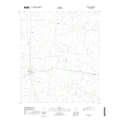
2019 Map of North Zulch
USGS Topo · Published 2019About this map
North Zulch serves as the primary hub of this Madison County landscape, situated at the junction of several key regional routes. The settlement pattern is characterized by small, dispersed communities including Mecca, George, and Cottonwood, reflecting the agricultural and ranching heritage of the Texas Post Oak Savannah. Water management and drainage are central to the terrain, evidenced by the North Zulch Reservoir and Santa Alina Ranch Lake, while a network of waterways like Kickapoo Cr and Iron Cr carve through the land. Genealogists may find interest in the centrally located Oxford Cem, which serves as a quiet landmark amidst the winding county roads. The map detail highlights the transition from larger ranching parcels to smaller residential plots, connected by named thoroughfares such as Jinkins Rd and FM 1452.
Find a feature on this map
31 named features on this map. Tap any name to fly to it.
Don’t see what you’re looking for? This feature index may not catch every label — zoom into the map to look around manually.
Map Details
Editions of this 2019 North Zulch Map
This is the sole edition of this map. No revisions or reprints were ever made.
Other maps of this area

1925 · Iola No 2
USGS Topo · 1:48,000

1931 · Iola
USGS Topo · 1:62,500

1953 · Palestine
USGS Topo · 1:250,000

1954 · Waco
USGS Topo · 1:250,000

1954 · Beaumont
USGS Topo · 1:250,000

1954 · Austin
USGS Topo · 1:250,000

1955 · Waco
USGS Topo · 1:250,000

1957 · Beaumont
USGS Topo · 1:250,000

1957 · Palestine
USGS Topo · 1:250,000

1959 · Clear Lake
USGS Topo · 1:24,000