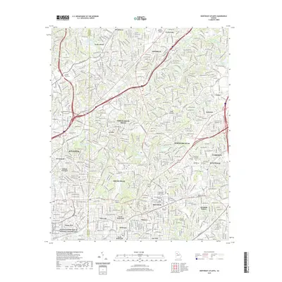
2020 Map of Northeast Atlanta
USGS Topo · Published 2020About this map
Martin Luther King Jr National Historic Site and the historic neighborhood of Inman Park anchor the southwestern corner of this survey, reflecting the deep cultural and civil rights heritage of central Atlanta. Moving northeast, the landscape transitions into the established academic corridors of Emory University and Agnes Scott College, where Lullwater Lake and Candler Lake dot the rolling terrain. The map documents the intricate confluence of the North Fork Peachtree Creek and South Fork Peachtree Creek, which carve through neighborhoods like Druid Hills and La Vista. In Decatur, the concentration of civic life is evident at the Dekalb County Courthouse, while the eastern portion of the quadrangle shows the residential and industrial growth around Scottdale and Avondale Estates. Modern infrastructure including Ga 400, I-85, and the Dekalb-Peachtree Airport define the northern bounds near Brookhaven and Chamblee.
Find a feature on this map
77 named features on this map. Tap any name to fly to it.
Don’t see what you’re looking for? This feature index may not catch every label — zoom into the map to look around manually.
Map Details
Editions of this 2020 Northeast Atlanta Map
This is the sole edition of this map. No revisions or reprints were ever made.
Other maps of this area

1888 · Atlanta
USGS Topo · 1:125,000

1890 · Atlanta
USGS Topo · 1:125,000

1892 · Atlanta
USGS Topo · 1:125,000

1895 · Atlanta
USGS Topo · 1:125,000

1953 · Atlanta
USGS Topo · 1:250,000

1954 · Conley
USGS Topo · 1:24,000

1954 · Chamblee
USGS Topo · 1:24,000

1954 · Decatur
USGS Topo · 1:24,000

1954 · Bolton
USGS Topo · 1:24,000

1954 · East Point
USGS Topo · 1:24,000