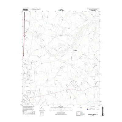
2016 Map of Northeast Lumberton
USGS Topo · Published 2016About this map
Lumberton serves as the focal point for this survey of Robeson County, where the urban grid gives way to a complex system of blackwater drainages and Carolina bays. The northeastern portion of the city is characterized by established neighborhoods like Elizabeth Heights, while the surrounding landscape is defined by the expansive Tenmile Swamp and White Oak Swamp. These low-lying areas dictate the settlement patterns of small communities such as Howellsville and Powers, which are situated on the slightly higher ground between water bodies. For genealogists, the map identifies several local burial sites including Thomas Cem, Lewis Cem, and Kinlaw Cem. The transport network follows a distinct pattern where roads like Barker Ten Mile Rd and Tolarsville Rd skirt the edges of wetlands, connecting the rural homesteads to the city center and the rail stop at Rozier Siding.
Find a feature on this map
130 named features on this map. Tap any name to fly to it.
Don’t see what you’re looking for? This feature index may not catch every label — zoom into the map to look around manually.
Map Details
Editions of this 2016 Northeast Lumberton Map
This is the sole edition of this map. No revisions or reprints were ever made.
Other maps of this area

1953 · Florence
USGS Topo · 1:250,000

1954 · Florence
USGS Topo · 1:250,000

1957 · Bladenboro
USGS Topo · 1:62,500

1959 · Saint Pauls
USGS Topo · 1:62,500

1972 · Northwest Lumberton
USGS Topo · 1:24,000

1972 · Southwest Lumberton
USGS Topo · 1:24,000

1972 · Rennert
USGS Topo · 1:24,000
1976 · Southwest Lumberton
USGS Topo · 1:24,000
1976 · Rennert
USGS Topo · 1:24,000
1976 · Northwest Lumberton
USGS Topo · 1:24,000