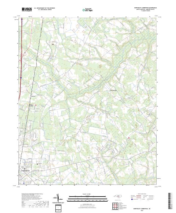
2022 Map of Northeast Lumberton
USGS Topo · Published 2022About this map
Lumberton expands northward into a landscape defined by an intricate network of Carolina bays and wetlands in this recent survey. The terrain is characterized by large, low-lying features such as Big Bay and Rafe Bay, which sit alongside the extensive White Oak Swamp and Tenmile Swamp. These swampy corridors have historically influenced the local road pattern, including the course of Barker Ten Mile Rd and the placement of rural settlements like Howellsville and Powers.
Find a feature on this map
137 named features on this map. Tap any name to fly to it.
Don’t see what you’re looking for? This feature index may not catch every label — zoom into the map to look around manually.
Map Details
Editions of this 2022 Northeast Lumberton Map
This is the sole edition of this map. No revisions or reprints were ever made.
Other maps of this area

1953 · Florence
USGS Topo · 1:250,000

1954 · Florence
USGS Topo · 1:250,000

1957 · Bladenboro
USGS Topo · 1:62,500

1959 · Saint Pauls
USGS Topo · 1:62,500

1972 · Northwest Lumberton
USGS Topo · 1:24,000

1972 · Southwest Lumberton
USGS Topo · 1:24,000

1972 · Rennert
USGS Topo · 1:24,000
1976 · Southwest Lumberton
USGS Topo · 1:24,000
1976 · Rennert
USGS Topo · 1:24,000
1976 · Northwest Lumberton
USGS Topo · 1:24,000