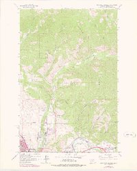
1964 Map of Northeast Missoula
USGS Topo · Published 1978About this map
The Clark Fork and Rattlesnake Creek converge at the foot of Mount Jumbo, defining the eastern gateway to Missoula during the mid-1960s. This survey, photorevised in the late 1970s, documents the city's residential expansion through the Rattlesnake School area and the industrial character of Bandmann Flats. The infrastructure of the era is evident in the Williams Ditch and the Pipeline crossing the northern gulches, while the southern valley floor shows established communities like East Missoula and West Riverside along the riverbanks.
Find a feature on this map
37 named features on this map. Tap any name to fly to it.
Don’t see what you’re looking for? This feature index may not catch every label — zoom into the map to look around manually.
Map Details
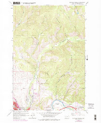
Editions of this 1964 Northeast Missoula Map
3 editions found

Other maps of this area

1903 · Bonner
USGS Topo · 1:125,000

1912 · Missoula
USGS Topo · 1:125,000

1921 · Elbow Lake
USGS Topo · 1:125,000

1947 · Butte
USGS Topo · 1:250,000

1955 · Choteau
USGS Topo · 1:250,000

1956 · Wallace
USGS Topo · 1:250,000

1956 · Hamilton
USGS Topo · 1:250,000

1957 · Choteau
USGS Topo · 1:250,000

1958 · Butte
USGS Topo · 1:250,000

1958 · Choteau
USGS Topo · 1:250,000