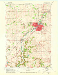
1960 Map of Northfield
USGS Topo · Published 1973About this map
St Olaf College and Carleton College dominate the upper bluffs of the Cannon River valley in this 1960 survey of Northfield. The city's mid-century expansion is visible through a grid of residential streets including Washington St and Fremont St, while the Cannon River serves as the industrial and geographical spine of the region. A dense network of competing rail lines, including the Chicago Milwaukee St Paul and Pacific and the Great Western, converge near the M N & S Sta, illustrating the area's importance as a transportation hub for both passengers and regional commerce.
Find a feature on this map
48 named features on this map. Tap any name to fly to it.
Don’t see what you’re looking for? This feature index may not catch every label — zoom into the map to look around manually.
Map Details
Editions of this 1960 Northfield Map
2 editions found
Other maps of this area

1953 · Saint Paul
USGS Topo · 1:250,000

1957 · Farmington
USGS Topo · 1:62,500

1957 · Prior Lake
USGS Topo · 1:62,500

1959 · Saint Paul
USGS Topo · 1:250,000

1960 · Faribault
USGS Topo · 1:24,000

1960 · Northfield
USGS Topo · 1:24,000

1960 · Cannon City
USGS Topo · 1:24,000

1960 · Dennison
USGS Topo · 1:24,000

1960 · Little Chicago
USGS Topo · 1:24,000

1960 · Nerstrand
USGS Topo · 1:24,000