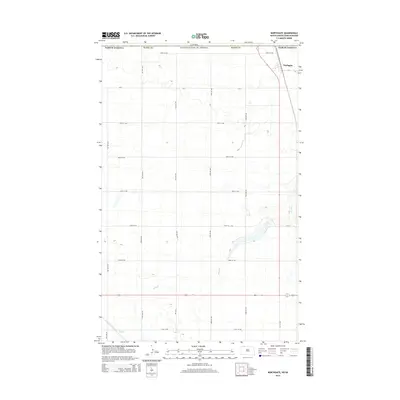
2014 Map of Northgate
USGS Topo · Published 2014About this map
The border town of Northgate sits at the intersection of international diplomacy and the rural high plains of North Dakota. Situated in Burke County along the boundary with Saskatchewan, Canada, the area is defined by a strictly surveyed grid of county roads and section lines. Notable local routes like Cr-2 and 71st Ave NW facilitate travel across this agricultural landscape. The most prominent natural feature is the winding path of Stony Creek, which cuts through the prairie southeast of the main settlement. This topographic study reveals the sparse but methodical arrangement of a borderland community, where the land is organized into 100-foot contour intervals that trace the subtle drainage patterns feeding into the creek system.
Find a feature on this map
19 named features on this map. Tap any name to fly to it.
Don’t see what you’re looking for? This feature index may not catch every label — zoom into the map to look around manually.
Map Details
Editions of this 2014 Northgate Map
This is the sole edition of this map. No revisions or reprints were ever made.
Other maps of this area

1947 · Bowbells NW
USGS Topo · 1:24,000

1947 · Flaxton
USGS Topo · 1:24,000

1947 · Bowbells
USGS Topo · 1:24,000

1948 · Flaxton
USGS Topo · 1:24,000

1948 · Coteau
USGS Topo · 1:24,000

1948 · Woburn
USGS Topo · 1:24,000

1949 · Bowbells
USGS Topo · 1:24,000

1949 · Bowbells NW
USGS Topo · 1:24,000
1949 · Northgate
USGS Topo · 1:24,000

1950 · Bowbells
USGS Topo · 1:62,500