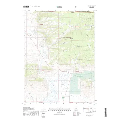
2019 Map of Northgate
USGS Topo · Published 2019About this map
Northgate stands as a focal point in this high-elevation landscape where the North Platte River and Canadian River converge near the Wyoming-Colorado border. This 2019 survey captures a complex network of agricultural and wildlife management infrastructure, including the southern reaches of the Arapaho National Wildlife Refuge and the marshes of North Park. The terrain is defined by prominent peaks such as Independence Mtn and Sentinel Mtn, which rise sharply from the river valleys. A dense system of historical irrigation ditches, including Canadian Ditch, Durgin Ditch, and Capron Ditch, illustrates the long-standing efforts to manage water rights in this arid western basin. The map also highlights the overlapping boundaries of the Medicine Bow National Forest and Routt National Forest, underscoring the area's significance for public land management and outdoor recreation through trails like the Pinkham Mountain Loop.
Find a feature on this map
45 named features on this map. Tap any name to fly to it.
Don’t see what you’re looking for? This feature index may not catch every label — zoom into the map to look around manually.
Map Details
Editions of this 2019 Northgate Map
This is the sole edition of this map. No revisions or reprints were ever made.
Other maps of this area

1906 · Medicine Bow
USGS Topo · 1:125,000

1908 · Medicine Bow
USGS Topo · 1:125,000

1950 · Northgate
USGS Topo · 1:24,000

1950 · Kings Canyon
USGS Topo · 1:24,000

1952 · Northgate
USGS Topo · 1:24,000

1952 · Kings Canyon
USGS Topo · 1:24,000

1954 · Rawlins
USGS Topo · 1:250,000

1954 · Craig
USGS Topo · 1:250,000

1955 · Independence Mountain
USGS Topo · 1:24,000

1955 · Lake John
USGS Topo · 1:24,000