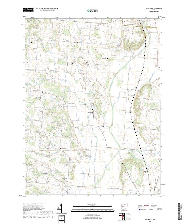
2023 Map of Northville
USGS Topo · Published 2023About this map
Northville and Lippincott anchor this portion of Champaign County, where the agricultural grid meets the winding course of the Mad River. The landscape is a network of township roads and family-named cemeteries that reflect generations of local settlement. Numerous small burial grounds, such as Scott and Pullins Cem and Sullivans Cem, are scattered across the farmland, often situated near minor watercourses like Muddy Creek and Glady Creek.
Find a feature on this map
71 named features on this map. Tap any name to fly to it.
Don’t see what you’re looking for? This feature index may not catch every label — zoom into the map to look around manually.
Map Details
Editions of this 2023 Northville Map
This is the sole edition of this map. No revisions or reprints were ever made.
Other maps of this area

1913 · Bellefontaine
USGS Topo · 1:48,000

1913 · East Liberty
USGS Topo · 1:62,500

1914 · St. Paris
USGS Topo · 1:62,500

1914 · Mechanicsburg
USGS Topo · 1:62,500

1915 · Bellefontaine
USGS Topo · 1:62,500

1915 · East Liberty
USGS Topo · 1:62,500

1916 · Mechanicsburg
USGS Topo · 1:62,500

1916 · St. Paris
USGS Topo · 1:62,500

1944 · East Liberty
USGS Topo · 1:62,500

1944 · Mechanicsburg
USGS Topo · 1:62,500