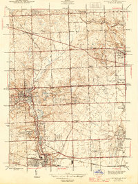
1945 Map of Northville
USGS Topo · Published 1945About this map
Northville and Plymouth anchor a landscape of mid-century growth along the Middle Rouge River and its various impoundments. The map documents an era when the Detroit suburbs were expanding into rural territory, though significant institutional and recreational grounds still dominated the terrain. Landmarks such as the Wayne County Training Sch and the Fair Grounds north of Seven Mile Road reflect a period when large-scale civic projects were central to the regional character.
Find a feature on this map
82 named features on this map. Tap any name to fly to it.
Don’t see what you’re looking for? This feature index may not catch every label — zoom into the map to look around manually.
Map Details
Editions of this 1945 Northville Map
2 editions found
Other maps of this area

1902 · South Lyon
USGS Topo · 1:62,500

1904 · Ann Arbor
USGS Topo · 1:125,000

1905 · Wayne
USGS Topo · 1:62,500

1906 · South Lyon
USGS Topo · 1:62,500

1907 · Pontiac
USGS Topo · 1:62,500

1908 · Ann Arbor
USGS Topo · 1:125,000

1909 · Milford
USGS Topo · 1:62,500

1912 · Wayne
USGS Topo · 1:62,500

1936 · Inkster
USGS Topo · 1:31,680

1936 · Wayne
USGS Topo · 1:31,680