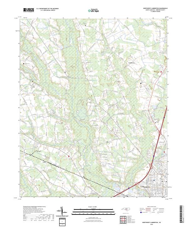
2022 Map of Northwest Lumberton
USGS Topo · Published 2022About this map
Raft Swamp and the Lumber River dominate the low-lying terrain of Robeson County in this modern survey, which details the rural-to-urban transition of Lumberton. The map documents a landscape defined by significant water systems, including Richland Swamp and Holy Swamp, which weave between agricultural holdings and residential developments. Genealogists will find several family-named burial grounds and local landmarks, such as Boone Cem, McNeill Cem, and Gardens of Faith. Smaller outlying settlements like Saddletree and Lowe are shown with their local road networks and community centers, including Clyburn Church and Evergreen Church. The infrastructure reflects the area's continued reliance on the river and swamps for drainage, while modern transportation corridors bypass older hamlets, showing how the regional footprint has evolved from its colonial and early industrial roots.
Find a feature on this map
169 named features on this map. Tap any name to fly to it.
Don’t see what you’re looking for? This feature index may not catch every label — zoom into the map to look around manually.
Map Details
Editions of this 2022 Northwest Lumberton Map
This is the sole edition of this map. No revisions or reprints were ever made.
Other maps of this area

1953 · Florence
USGS Topo · 1:250,000

1954 · Florence
USGS Topo · 1:250,000

1957 · Bladenboro
USGS Topo · 1:62,500

1959 · Saint Pauls
USGS Topo · 1:62,500

1972 · Northwest Lumberton
USGS Topo · 1:24,000

1972 · Southwest Lumberton
USGS Topo · 1:24,000

1972 · Rennert
USGS Topo · 1:24,000

1972 · Pembroke
USGS Topo · 1:24,000
1972 · Mc Donald
USGS Topo · 1:24,000
1974 · Red Springs
USGS Topo · 1:24,000