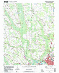
1997 Map of Northwest Lumberton
USGS Topo · Published 2000About this map
Raft Swamp dominates the central drainage of this North Carolina landscape, where the meandering waters of the Lumber River meet the growing outskirts of Lumberton. The terrain is defined by a dense network of blackwater streams and elliptical depressions, including Jacob Bay and the smaller Circle T Lake, which reflect the unique coastal plain geography of Robeson County. This map highlights the transition from rural agricultural land to suburban expansion at the end of the twentieth century.
Find a feature on this map
60 named features on this map. Tap any name to fly to it.
Don’t see what you’re looking for? This feature index may not catch every label — zoom into the map to look around manually.
Map Details
Editions of this 1997 Northwest Lumberton Map
This is the sole edition of this map. No revisions or reprints were ever made.
Other maps of this area

1953 · Florence
USGS Topo · 1:250,000

1954 · Florence
USGS Topo · 1:250,000

1957 · Bladenboro
USGS Topo · 1:62,500

1959 · Saint Pauls
USGS Topo · 1:62,500

1972 · Northwest Lumberton
USGS Topo · 1:24,000

1972 · Southwest Lumberton
USGS Topo · 1:24,000

1972 · Rennert
USGS Topo · 1:24,000

1972 · Pembroke
USGS Topo · 1:24,000
1972 · Mc Donald
USGS Topo · 1:24,000
1974 · Red Springs
USGS Topo · 1:24,000