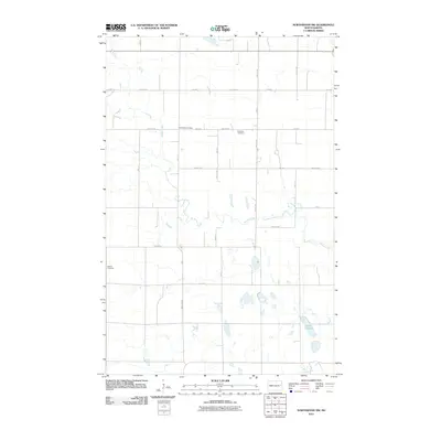
2011 Map of Northwood NW
USGS Topo · Published 2011About this map
Spring Creek meanders through the central plains of North Dakota, defining the agricultural landscape of Steele County in the early 21st century. This survey documents a rural environment organized by a rigorous grid of section lines, including County Hwy 20 and various numbered avenues like 3rd Ave NE. The map offers significant detail for genealogical researchers, anchoring the local history of Beaver Creek Township with three distinct burial sites: Hanson Cemetery in the west, and both Herlickson Cemetery and Bethania Cemetery further east. The southern portion of the quadrangle features the basin of Lake Tobiason, where the drainage of Beaver Creek begins to emerge. The sparse distribution of farmstead structures among these water bodies and burial grounds reflects a stable, low-density ranching and farming economy typical of the Red River Valley hinterlands.
Find a feature on this map
23 named features on this map. Tap any name to fly to it.
Don’t see what you’re looking for? This feature index may not catch every label — zoom into the map to look around manually.
Map Details
Editions of this 2011 Northwood NW Map
This is the sole edition of this map. No revisions or reprints were ever made.
Other maps of this area

1936 · Larimore
USGS Topo · 1:62,500

1939 · Niagara
USGS Topo · 1:62,500

1952 · Grand Forks
USGS Topo · 1:250,000

1956 · Grand Forks
USGS Topo · 1:250,000

1963 · Kempton
USGS Topo · 1:24,000

1963 · Larimore SW
USGS Topo · 1:24,000

1963 · Logan Center
USGS Topo · 1:24,000

1966 · Grand Forks
USGS Topo · 1:250,000

1967 · Finley NE
USGS Topo · 1:24,000

1967 · Finley
USGS Topo · 1:24,000