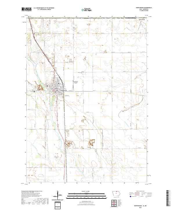
2022 Map of Northwood
USGS Topo · Published 2022About this map
Worth County Courthouse anchors the seat of local government in Northwood, where a precise grid of residential streets and avenues meets the winding course of the Shell Rock River. The landscape reflects a sophisticated system of agricultural management, defined by the straight lines of Ditch Number 11 and Ditch Number 40 that drain the fertile surrounding plains. Genealogists will find particular value in the variety of burial sites documented here, ranging from the well-established Sunset Rest Cem and South Shell Rock Cem to the intimate, private Seater Family Plot located north of the town center. The northern boundary of the map aligns with the Iowa-Minnesota state line, marked locally by Stateline Cem and the waters of Deer Creek.
Find a feature on this map
65 named features on this map. Tap any name to fly to it.
Don’t see what you’re looking for? This feature index may not catch every label — zoom into the map to look around manually.
Map Details
Editions of this 2022 Northwood Map
This is the sole edition of this map. No revisions or reprints were ever made.
Other maps of this area

1954 · Albert Lea
USGS Topo · 1:62,500

1954 · Hayward
USGS Topo · 1:62,500

1954 · Mason City
USGS Topo · 1:250,000

1957 · Mason City
USGS Topo · 1:250,000

1958 · Mason City
USGS Topo · 1:250,000

1972 · Manly
USGS Topo · 1:24,000

1972 · Northwood
USGS Topo · 1:24,000

1972 · Fertile NE
USGS Topo · 1:24,000
1972 · Fertile SE
USGS Topo · 1:24,000
1972 · Grafton
USGS Topo · 1:24,000