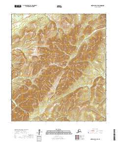
2017 Map of Norton Bay A-1 SW
USGS Topo · Published 2017About this map
Unalakleet River and the Rodo River define the hydraulic character of this remote Alaskan interior within the Yukon-Koyukuk Census Area. This 2017 survey documents the complex topography of the Norton Bay region, where the rivers navigate a landscape defined by significant elevation changes and deep drainage basins. The map illustrates the transition from the winding course of the Unalakleet in the northwest toward the south-flowing Rodo River. Beyond these primary watercourses, the terrain is marked by township divisions such as t16s r4w and t17s r3w, which delineate the vast, undeveloped sections of the public land survey system. This document serves as a detailed study of the area's hydrology and relief, providing a clear record of the river systems before any significant modern encroachment or infrastructure development in this specific quadrangle.
Find a feature on this map
6 named features on this map. Tap any name to fly to it.
Don’t see what you’re looking for? This feature index may not catch every label — zoom into the map to look around manually.
Map Details
Editions of this 2017 Norton Bay A-1 SW Map
This is the sole edition of this map. No revisions or reprints were ever made.
Other maps of this area

1948 · Norton Bay
USGS Topo · 1:250,000

1951 · Unalakleet
USGS Topo · 1:250,000

1951 · Norton Bay
USGS Topo · 1:250,000

1952 · Unalakleet D-2
USGS Topo · 1:63,360

1952 · Unalakleet D-1
USGS Topo · 1:63,360

1952 · Unalakleet
USGS Topo · 1:250,000
1953 · Norton Bay A-2
USGS Topo · 1:63,360
1954 · Norton Bay A-1
USGS Topo · 1:63,360

1955 · Norton Bay
USGS Topo · 1:250,000

1964 · Unalakleet
USGS Topo · 1:250,000