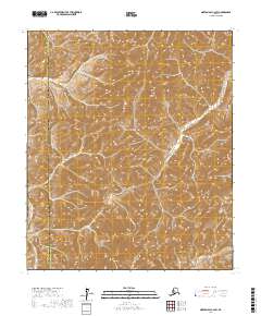
2017 Map of Norton Bay C-2 SW
USGS Topo · Published 2017About this map
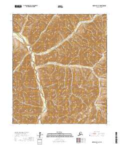
Debauch Mtn rises as a prominent landmark in this interior portion of the Alaska wilderness, where the 2017 terrain is defined by complex contouring and remote drainage systems. The landscape is bisected by the boundary between the Nome Census Area and the Yukon-Koyukuk Census Area, a division that marks this high-altitude region's administrative geography. Flowing through the eastern sections of the quadrangle, Brass Pan Cr serves as the primary watercourse, cutting through the steep slopes and providing a natural corridor for any historical travel or prospecting through these uplands. This 2017 edition records the land's surface as it appeared in the early 21st century, illustrating the township and range survey lines of T10S and T11S across a territory largely untouched by permanent settlements or roads.
Find a feature on this map
9 named features on this map. Tap any name to fly to it.
Don’t see what you’re looking for? This feature index may not catch every label — zoom into the map to look around manually.
Map Details
Editions of this 2017 Norton Bay C-2 SW Map
This is the sole edition of this map. No revisions or reprints were ever made.
Other maps of this area

1948 · Norton Bay
USGS Topo · 1:250,000

1950 · Norton Bay B-3
USGS Topo · 1:63,360

1950 · Norton Bay C-3
USGS Topo · 1:63,360

1951 · Norton Bay
USGS Topo · 1:250,000
1953 · Norton Bay B-2
USGS Topo · 1:63,360

1953 · Norton Bay C-2
USGS Topo · 1:63,360

1955 · Norton Bay
USGS Topo · 1:250,000
2017 · Norton Bay C-3 NE
USGS Topo · 1:25,000
2017 · Norton Bay B-3 NE
USGS Topo · 1:25,000
2017 · Norton Bay C-2 NE
USGS Topo · 1:25,000