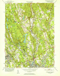
1951 Map of Norwalk North
USGS Topo · Published 1952About this map
Norwalk and Wilton are connected by the valley of the Norwalk River in this early 1950s survey of Fairfield County. The landscape is characterized by a series of north-south ridges such as Sturges Ridge, Belden Hill, and Brushy Ridge, which shaped the development of local roads and the New York New Haven and Hartford railroad line. Toward the south, the Merritt Parkway and Boston Post Road signal the area's increasing connectivity and suburban growth.
Find a feature on this map
85 named features on this map. Tap any name to fly to it.
Don’t see what you’re looking for? This feature index may not catch every label — zoom into the map to look around manually.
Map Details
Editions of this 1951 Norwalk North Map
4 editions found
Other maps of this area

1892 · Stamford
USGS Topo · 1:62,500

1892 · Danbury
USGS Topo · 1:62,500

1892 · Norwalk
USGS Topo · 1:62,500

1892 · Carmel
USGS Topo · 1:62,500

1893 · Carmel
USGS Topo · 1:62,500

1893 · Stamford
USGS Topo · 1:62,500

1893 · Norwalk
USGS Topo · 1:62,500

1894 · Carmel
USGS Topo · 1:62,500

1899 · Stamford
USGS Topo · 1:62,500

1915 · Danbury
USGS Topo · 1:62,500