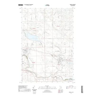
2019 Map of Norway
USGS Topo · Published 2019About this map
Norway stands at the center of this 2019 survey, illustrating the industrial and residential development of the Menominee Iron Range. The map details the complex geography along the Menominee River, where the state line divides Michigan and Wisconsin. Settlement patterns are concentrated in the towns of Quinnesec and Niagara, while the surrounding landscape is marked by the legacy of mining and transport, including the E & Ls Rr and the Iron Mountain to Norway State Trail.
Find a feature on this map
125 named features on this map. Tap any name to fly to it.
Don’t see what you’re looking for? This feature index may not catch every label — zoom into the map to look around manually.
Map Details
Editions of this 2019 Norway Map
This is the sole edition of this map. No revisions or reprints were ever made.
Other maps of this area

1939 · Pembine
USGS Topo · 1:48,000

1939 · Dunbar
USGS Topo · 1:48,000

1939 · Iron Mountain
USGS Topo · 1:48,000

1941 · Dunbar
USGS Topo · 1:48,000

1941 · Iron Mountain
USGS Topo · 1:48,000

1947 · Pembine
USGS Topo · 1:48,000

1947 · Dunbar
USGS Topo · 1:48,000

1947 · Iron Mountain
USGS Topo · 1:48,000

1954 · Iron Mountain
USGS Topo · 1:250,000

1954 · Escanaba
USGS Topo · 1:250,000