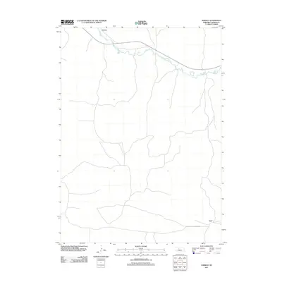
2011 Map of Norway
USGS Topo · Published 2011About this map
Middle Loup River meanders across the northern portion of this Thomas County landscape, following a winding course through the Nebraska Sandhills. The small settlement of Norway sits on the northern bank, marking a point of human activity along the water's edge. To the south, the terrain transition is marked by the winding path of Johnston Rd, which skirts the southern hills and leads toward the Pearson Ranch. The map reveals a sparse, rural pattern of settlement typical of the High Plains, where vast cattle ranching operations and isolated homesteads are the primary features of the land. This 2011 survey captures the area's enduring character as an open pastoral expanse defined more by its watercourses and topographic contours than by dense development.
Find a feature on this map
4 named features on this map. Tap any name to fly to it.
Don’t see what you’re looking for? This feature index may not catch every label — zoom into the map to look around manually.
Map Details
Editions of this 2011 Norway Map
This is the sole edition of this map. No revisions or reprints were ever made.
Other maps of this area

1948 · Seneca
USGS Topo · 1:62,500

1948 · Thedford
USGS Topo · 1:62,500

1948 · Seneca 4
USGS Topo · 1:62,500

1949 · Seneca 4
USGS Topo · 1:62,500

1950 · Thedford
USGS Topo · 1:62,500

1950 · Shimmins Lake
USGS Topo · 1:62,500

1951 · Seneca
USGS Topo · 1:62,500

1954 · North Platte
USGS Topo · 1:250,000

1956 · North Platte
USGS Topo · 1:250,000

1957 · North Platte
USGS Topo · 1:250,000