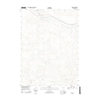
2014 Map of Norway
USGS Topo · Published 2014About this map
Norway serves as the primary landmark in this section of Thomas County, situated along the northern curve of the Middle Loup River. This 2014 survey documents the undulating topography of the Nebraska Sandhills, where the landscape is defined more by its drainage patterns and named ranch roads than by dense urban development. The transportation corridor follows the river valley, with Ne-2 and the Sandhills Journey providing the main east-west passage through the dunes. Evidence of local ranching and land use is visible in the network of secondary routes including Windmill Rd, Johnston Ln, and Diamond E Ln. These routes weave through the sand hills, connecting remote homesteads and windmill sites to the central valley and the river's winding course.
Find a feature on this map
9 named features on this map. Tap any name to fly to it.
Don’t see what you’re looking for? This feature index may not catch every label — zoom into the map to look around manually.
Map Details
Editions of this 2014 Norway Map
This is the sole edition of this map. No revisions or reprints were ever made.
Other maps of this area

1948 · Seneca
USGS Topo · 1:62,500

1948 · Thedford
USGS Topo · 1:62,500

1948 · Seneca 4
USGS Topo · 1:62,500

1949 · Seneca 4
USGS Topo · 1:62,500

1950 · Thedford
USGS Topo · 1:62,500

1950 · Shimmins Lake
USGS Topo · 1:62,500

1951 · Seneca
USGS Topo · 1:62,500

1954 · North Platte
USGS Topo · 1:250,000

1956 · North Platte
USGS Topo · 1:250,000

1957 · North Platte
USGS Topo · 1:250,000