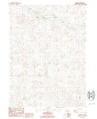
1986 Map of Norway
USGS Topo · Published 1987About this map
The Middle Loup River meanders across this Thomas County landscape, carving a distinct valley through the Nebraska sandhills. Along its northern banks, the Burlington Northern railroad corridor parallels the water, connecting the small settlement of Norway to the wider region. This mid-1980s survey illustrates a rural economy defined by cattle ranching and light industry, notably centered on the Pearson Ranch in the southeast and a localized Quarry near the river. The map's contour lines reveal the intricate, undulating topography of the dunes, which dominate the area away from the river’s floodplain. These topographical details, combined with section lines like the boundary between T 23 N and T 22 N, provide a precise look at land use and natural drainage patterns in this portion of the Nebraska interior.
Find a feature on this map
6 named features on this map. Tap any name to fly to it.
Don’t see what you’re looking for? This feature index may not catch every label — zoom into the map to look around manually.
Map Details
Editions of this 1986 Norway Map
This is the sole edition of this map. No revisions or reprints were ever made.
Other maps of this area

1948 · Seneca
USGS Topo · 1:62,500

1948 · Thedford
USGS Topo · 1:62,500

1948 · Seneca 4
USGS Topo · 1:62,500

1949 · Seneca 4
USGS Topo · 1:62,500

1950 · Thedford
USGS Topo · 1:62,500

1950 · Shimmins Lake
USGS Topo · 1:62,500

1951 · Seneca
USGS Topo · 1:62,500

1954 · North Platte
USGS Topo · 1:250,000

1956 · North Platte
USGS Topo · 1:250,000

1957 · North Platte
USGS Topo · 1:250,000