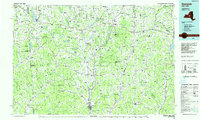
1986 Map of Norwich
USGS Topo · Published 1986About this map
Colgate University anchors the landscape of central New York in this mid-1980s planimetric study, which illustrates the dense network of small villages and water-management features across Chenango and Madison Counties. The city of Norwich serves as a primary hub along the Chenango River, with notable landmarks such as the Chenango County Courthouse and Mt Hope Cem marking the local topography.
Find a feature on this map
208 named features on this map. Tap any name to fly to it.
Don’t see what you’re looking for? This feature index may not catch every label — zoom into the map to look around manually.
Map Details
Editions of this 1986 Norwich Map
2 editions found
Other maps of this area

1895 · Chittenango
USGS Topo · 1:62,500

1895 · Oriskany
USGS Topo · 1:62,500

1895 · Syracuse
USGS Topo · 1:62,500

1895 · Oneida
USGS Topo · 1:62,500

1897 · Cazenovia
USGS Topo · 1:62,500

1898 · Oneida
USGS Topo · 1:62,500

1898 · Syracuse
USGS Topo · 1:62,500

1898 · Chittenango
USGS Topo · 1:62,500

1898 · Utica
USGS Topo · 1:62,500

1898 · Oriskany
USGS Topo · 1:62,500