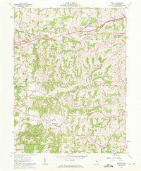
1961 Map of Norwich
USGS Topo · Published 1963About this map
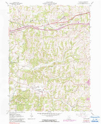
Chandlersville serves as a focal point in the southern portion of this Muskingum County landscape, where the local community is anchored by the Chandlersville Cem and nearby Salt Creek Ch. The terrain is defined by the complex drainage of Salt Creek and its many tributaries, including White Eyes Creek and Buffalo Fork. In the northern section, the village of Norwich and the hamlet of Sundale sit along the Baltimore and Ohio railroad corridor, which parallels an early proposed highway route. This 1961 survey captures the area just before significant modernization of the regional road network, preserving the location of family-named landmarks like Smith Mill and the Perry Sch. The southern reaches are dominated by the wooded expanse of the Blue Rock State Forest, illustrating the transition from agricultural valley floors to upland timber conservation.
Find a feature on this map
33 named features on this map. Tap any name to fly to it.
Don’t see what you’re looking for? This feature index may not catch every label — zoom into the map to look around manually.
Map Details
Editions of this 1961 Norwich Map
5 editions found
Other maps of this area

1908 · Conesville
USGS Topo · 1:62,500

1909 · Cambridge
USGS Topo · 1:62,500

1910 · Philo
USGS Topo · 1:62,500

1910 · Conesville
USGS Topo · 1:62,500

1911 · Cumberland
USGS Topo · 1:62,500

1912 · Cambridge
USGS Topo · 1:62,500

1949 · Clarksburg
USGS Topo · 1:250,000

1951 · Canton
USGS Topo · 1:250,000

1953 · Canton
USGS Topo · 1:250,000

1956 · Clarksburg
USGS Topo · 1:250,000