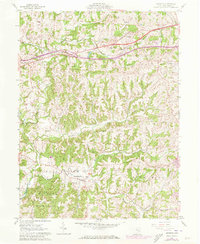
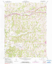
1961 Map of Norwich
USGS Topo · Published 1973About this map
Chandlersville serves as a prominent focal point in the southern portion of this landscape, situated near the confluence of Buffalo Fork and Williams Fork. The area exhibits a pattern of small settlements and rural landmarks, including the Chandlersville Cem and the nearby Salt Creek Cem. Further north, the village of Norwich is positioned along the Baltimore and Ohio rail line, which cuts across the terrain alongside the growing highway infrastructure.
Find a feature on this map
32 named features on this map. Tap any name to fly to it.
Don’t see what you’re looking for? This feature index may not catch every label — zoom into the map to look around manually.
Map Details
Editions of this 1961 Norwich Map
5 editions found
Other maps of this area

1908 · Conesville
USGS Topo · 1:62,500

1909 · Cambridge
USGS Topo · 1:62,500

1910 · Philo
USGS Topo · 1:62,500

1910 · Conesville
USGS Topo · 1:62,500

1911 · Cumberland
USGS Topo · 1:62,500

1912 · Cambridge
USGS Topo · 1:62,500

1949 · Clarksburg
USGS Topo · 1:250,000

1951 · Canton
USGS Topo · 1:250,000

1953 · Canton
USGS Topo · 1:250,000

1956 · Clarksburg
USGS Topo · 1:250,000