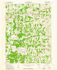
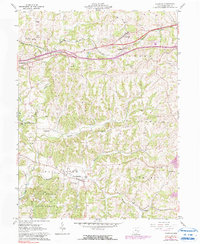
1961 Map of Norwich
USGS Topo · Published 1963About this map
Norwich and Bridgeville anchor the northern landscape of this Muskingum County study, where the Baltimore and Ohio Railroad cuts through the rolling hills of Perry and Union townships. The map records a rural economy defined by scattered settlements and natural resources, evidenced by the extensive Blue Rock State Forest and the numerous oil and gas wells dotting the drainages of Salt Creek and Georges Run.
Find a feature on this map
32 named features on this map. Tap any name to fly to it.
Don’t see what you’re looking for? This feature index may not catch every label — zoom into the map to look around manually.
Map Details
Editions of this 1961 Norwich Map
5 editions found
Other maps of this area

1908 · Conesville
USGS Topo · 1:62,500

1909 · Cambridge
USGS Topo · 1:62,500

1910 · Philo
USGS Topo · 1:62,500

1910 · Conesville
USGS Topo · 1:62,500

1911 · Cumberland
USGS Topo · 1:62,500

1912 · Cambridge
USGS Topo · 1:62,500

1949 · Clarksburg
USGS Topo · 1:250,000

1951 · Canton
USGS Topo · 1:250,000

1953 · Canton
USGS Topo · 1:250,000

1956 · Clarksburg
USGS Topo · 1:250,000