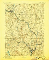
1892 Map of Norwich
USGS Topo · Published 1906About this map
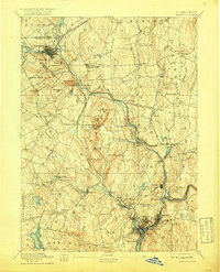
Norwich and the manufacturing center of Willimantic anchor this late nineteenth-century survey, which reveals a landscape deeply defined by the confluence of the Thames River and its major tributaries. The industrial output of the era is evident in the dense rail networks of the New York and New England Railroad and the New London Northern Railroad, which connect mill towns like Versailles and Taftville to the broader regional economy. Away from the river valleys, the terrain is dotted with ancestral hill names such as Obwebetuck Hill and Pautipaug Hill, while social life is marked by the Camp Meeting grounds near Prospect Hill. The map meticulously captures the transition from rural agricultural hamlets like Bozrah Street and Scotland to the burgeoning industrial hubs at the river forks, providing an essential record of eastern Connecticut's late-Victorian development and its intricate water-powered infrastructure.
Find a feature on this map
97 named features on this map. Tap any name to fly to it.
Don’t see what you’re looking for? This feature index may not catch every label — zoom into the map to look around manually.
Map Details
Editions of this 1892 Norwich Map
8 editions found
Other maps of this area

1889 · Stonington
USGS Topo · 1:62,500

1889 · Putnam
USGS Topo · 1:62,500

1889 · Moosup
USGS Topo · 1:62,500

1892 · Woodstock
USGS Topo · 1:62,500

1892 · Tolland
USGS Topo · 1:62,500

1892 · New London
USGS Topo · 1:62,500

1892 · Norwich
USGS Topo · 1:62,500

1892 · Gilead
USGS Topo · 1:62,500

1893 · Putnam
USGS Topo · 1:62,500

1893 · Moosup
USGS Topo · 1:62,500