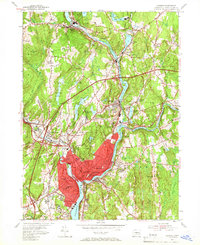
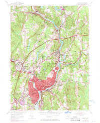
1954 Map of Norwich
USGS Topo · Published 1961About this map
The Shetucket River and Quinebaug River converge in this mid-century portrait of Norwich, where industrial and residential growth follow the winding valley floors. The landscape is marked by a complex network of reservoirs and ponds, such as Bog Meadow Reservoir and Paper Mill Pond, which historically supported the region's manufacturing base. The newly added Connecticut Turnpike cuts across the terrain, signaling a shift in transportation as it bypasses older rail-centered hubs like Versailles Sta and Taftville.
Find a feature on this map
81 named features on this map. Tap any name to fly to it.
Don’t see what you’re looking for? This feature index may not catch every label — zoom into the map to look around manually.
Map Details
Editions of this 1954 Norwich Map
5 editions found
Other maps of this area

1889 · Stonington
USGS Topo · 1:62,500

1889 · Moosup
USGS Topo · 1:62,500

1892 · New London
USGS Topo · 1:62,500

1892 · Norwich
USGS Topo · 1:62,500

1893 · Moosup
USGS Topo · 1:62,500

1893 · Stonington
USGS Topo · 1:62,500

1893 · New London
USGS Topo · 1:62,500

1920 · Moosup
USGS Topo · 1:62,500

1921 · New London
USGS Topo · 1:62,500

1921 · Stonington
USGS Topo · 1:62,500