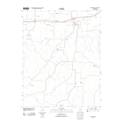
2011 Map of Norwood
USGS Topo · Published 2011About this map
Norwood serves as a local hub in Wright County, situated along the BNSF Railway corridor and the modern alignment of Old Hwy 60. The landscape is defined by the winding paths of Dry Creek and the South Fork Dry Creek, which cut through the hills near Mary Gray Hill and Samson Hollow. This 2011 survey reveals a settlement pattern anchored by small community centers like Macomb and the more isolated Filer near Tick Ridge. Genealogists will find a high density of family and community burial sites, including the Calhoun Cemetery, Ryan Cemetery, and Mount Harmon Cemetery, which are scattered among a network of county roads like Cottengim Rd and Chadwell Rd. In the southern portion of the quadrangle, the McIntosh Lake Dam controls the flow of Clever Creek, reflecting local water management in this rural Missouri landscape.
Find a feature on this map
72 named features on this map. Tap any name to fly to it.
Don’t see what you’re looking for? This feature index may not catch every label — zoom into the map to look around manually.
Map Details
Editions of this 2011 Norwood Map
This is the sole edition of this map. No revisions or reprints were ever made.
Other maps of this area

1936 · Ava
USGS Topo · 1:48,000

1937 · Buckhart
USGS Topo · 1:48,000

1942 · Ava
USGS Topo · 1:62,500

1943 · Buckhart
USGS Topo · 1:62,500

1945 · Ava
USGS Topo · 1:62,500

1945 · Harrison
USGS Topo · 1:250,000

1945 · Buckhart
USGS Topo · 1:62,500

1949 · Harrison
USGS Topo · 1:250,000

1951 · Norwood
USGS Topo · 1:24,000

1951 · Mountain Grove South
USGS Topo · 1:24,000