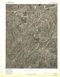
1977 Map of Norwood
USGS Topo · Published 1977About this map
Norwood and Macomb anchor this 1977 orthophotograph, which provides a high-altitude visual perspective of the Wright County landscape. Produced in cooperation with the Soil Conservation Service, the imagery reveals a distinct transition between the concentrated residential and rail-corridor development of Norwood and the surrounding mosaic of agricultural clearings and dense timber. Unlike standard topographic line maps, this photographic study captures the precise texture of the hillsides and the exact footprint of farmsteads at the end of the 1970s. The aerial view highlights the winding paths of rural roads and the drainage patterns that shaped local settlement, offering an unfiltered look at the Missouri Ozarks' rural infrastructure during a period of steady agrarian activity.
Find a feature on this map
2 named features on this map. Tap any name to fly to it.
Don’t see what you’re looking for? This feature index may not catch every label — zoom into the map to look around manually.
Map Details
Editions of this 1977 Norwood Map
This is the sole edition of this map. No revisions or reprints were ever made.
Other maps of this area

1936 · Ava
USGS Topo · 1:48,000

1937 · Buckhart
USGS Topo · 1:48,000

1942 · Ava
USGS Topo · 1:62,500

1943 · Buckhart
USGS Topo · 1:62,500

1945 · Ava
USGS Topo · 1:62,500

1945 · Harrison
USGS Topo · 1:250,000

1945 · Buckhart
USGS Topo · 1:62,500

1949 · Harrison
USGS Topo · 1:250,000

1951 · Norwood
USGS Topo · 1:24,000

1951 · Mountain Grove South
USGS Topo · 1:24,000