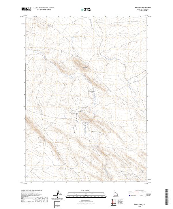
2024 Map of Notch Butte
USGS Topo · Published 2024About this map
The Bruneau Desert landscape dominates this high-altitude section of Owyhee County, characterized by a complex network of drainage systems and volcanic landforms. The terrain is defined by prominent elevations such as Notch Butte and Twin Buttes, which serve as significant landmarks in this arid environment. Hydrological features like Sailor Creek and Deadman Creek carve through the plateau, indicating the natural flow of water toward the Snake River plain. A single primary road, Crows Nest Rd, traverses the eastern and central portions of the map, providing the only major terrestrial link across the ridge. Notable topographic features like The Big Hill and the southeastern Blue Ridge underscore the elevation changes inherent in this desert plateau, reflecting the geomorphology of southwestern Idaho's interior.
Find a feature on this map
12 named features on this map. Tap any name to fly to it.
Don’t see what you’re looking for? This feature index may not catch every label — zoom into the map to look around manually.
Map Details
Editions of this 2024 Notch Butte Map
This is the sole edition of this map. No revisions or reprints were ever made.
Other maps of this area

1948 · Twentymile Butte
USGS Topo · 1:24,000

1948 · Glenns Ferry
USGS Topo · 1:62,500

1948 · Grindstone Butte
USGS Topo · 1:24,000
1949 · Grindstone Butte
USGS Topo · 1:24,000

1949 · Pasadena Valley
USGS Topo · 1:62,500

1949 · Indian Butte
USGS Topo · 1:24,000
1950 · Indian Butte
USGS Topo · 1:24,000
1951 · Glenns Ferry
USGS Topo · 1:62,500

1955 · Twin Falls
USGS Topo · 1:250,000

1956 · Blue Butte
USGS Topo · 1:62,500