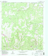
1964 Map of Nott Branch
USGS Topo · Published 1982About this map
Pedernales River frontage and the rugged creek systems of the Edwards Plateau define this 1960s landscape along the border of Gillespie and Kerr counties. The terrain is deeply incised by drainages such as Nott Branch, Spanish Oak Creek, and Goat Creek, creating a network of ridges and hollows that historically dictated the placement of ranching operations. Significant local history is preserved in the location of the Peril Cem and a single isolated Grave south of White Oak Creek, marking the early settlement of this ranching country.
Find a feature on this map
30 named features on this map. Tap any name to fly to it.
Don’t see what you’re looking for? This feature index may not catch every label — zoom into the map to look around manually.
Map Details
Editions of this 1964 Nott Branch Map
3 editions found
Other maps of this area

1894 · Kerrville
USGS Topo · 1:125,000

1954 · Llano
USGS Topo · 1:250,000

1955 · Llano
USGS Topo · 1:250,000

1956 · Llano
USGS Topo · 1:250,000

1964 · Morris Ranch
USGS Topo · 1:24,000

1964 · Nott Branch
USGS Topo · 1:24,000
1964 · Kerrville
USGS Topo · 1:24,000
1964 · Mountain Home
USGS Topo · 1:24,000
1964 · Hunt
USGS Topo · 1:24,000
1964 · Legion
USGS Topo · 1:24,000