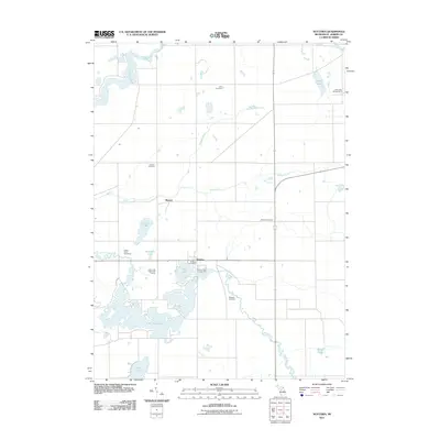
2011 Map of Nottawa
USGS Topo · Published 2011About this map
Wasepi and the surrounding township of Nottawa are defined by a complex network of waterways and glacial lakes in this early 21st-century study. The landscape is dominated by the expansive Lake Templene, fed and drained by the Prairie River, which winds through the southern portion of the quadrangle. Agricultural drainage is evident through the engineered Nottawa Ditch, while the natural flow of the Saint Joseph River and Spring Creek continues to shape the local geography.
Find a feature on this map
21 named features on this map. Tap any name to fly to it.
Don’t see what you’re looking for? This feature index may not catch every label — zoom into the map to look around manually.
Map Details
Editions of this 2011 Nottawa Map
This is the sole edition of this map. No revisions or reprints were ever made.
Other maps of this area

1914 · Three Rivers
USGS Topo · 1:62,500

1916 · Three Rivers
USGS Topo · 1:62,500

1918 · Leonidas
USGS Topo · 1:62,500

1922 · Schoolcraft
USGS Topo · 1:62,500

1943 · Three Rivers
USGS Topo · 1:62,500

1943 · Schoolcraft
USGS Topo · 1:62,500

1944 · Leonidas
USGS Topo · 1:62,500

1947 · Leonidas
USGS Topo · 1:62,500

1950 · Leonidas
USGS Topo · 1:62,500

1953 · Fort Wayne
USGS Topo · 1:250,000