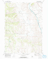
1970 Map of Nounan
USGS Topo · Published 1973About this map
Nounan Valley dominates this 1970s landscape, where the rural settlement of Nounan sits at the foot of Skinner Canyon. The map reveals a high-elevation environment defined by spring-fed drainages like Stauffer Creek and Co-op Creek flowing out of the Cache National Forest. In the east, the Bear River winds through the Bear Lake Valley, accompanied by the Union Pacific rail line and the Georgetown (Siding). This survey captures the region's agricultural and industrial foundations, featuring several Borrow Pits and Mines tucked into the western slopes. Genealogists can locate legacy sites such as Skinner Cem and Nounan Cem, while landmarks like Bartlett Lake and Poulsen Ridge provide clear reference points for those studying the 20th-century topography of Bear Lake County.
Find a feature on this map
30 named features on this map. Tap any name to fly to it.
Don’t see what you’re looking for? This feature index may not catch every label — zoom into the map to look around manually.
Map Details
Editions of this 1970 Nounan Map
2 editions found
Other maps of this area

1909 · Montpelier
USGS Topo · 1:125,000

1911 · Montpelier
USGS Topo · 1:125,000

1911 · Slug Creek
USGS Topo · 1:62,500

1915 · Preston
USGS Topo · 1:96,000

1918 · Preston
USGS Topo · 1:125,000

1948 · Soda Springs
USGS Topo · 1:62,500

1949 · Soda Springs
USGS Topo · 1:62,500

1955 · Preston
USGS Topo · 1:250,000

1958 · Preston
USGS Topo · 1:250,000

1962 · Preston
USGS Topo · 1:250,000