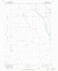
1970 Map of Nounan
USGS Topo · Published 1973About this map
Nounan and Georgetown anchor the agricultural and transport corridor of the Nounan Valley during the early 1970s. The landscape is defined by the Bear River, which flows alongside the Union Pacific railroad, a vital artery for the region's ranching and mining activities. Local history is preserved in the Nounan Cem and Skinner Cem, while the western edge of the quadrangle rises into the Cache National Forest, featuring landmarks like Poulsen Ridge and South Hill. Numerous Spring and Springs feed into a network of creeks including Skinner Creek and Stauffer Creek, illustrating the intricate water management required for valley life. Significant industrial marks, such as Mines and Borrow Pit locations, suggest the extraction economy that operated alongside traditional grazing land.
Find a feature on this map
27 named features on this map. Tap any name to fly to it.
Don’t see what you’re looking for? This feature index may not catch every label — zoom into the map to look around manually.
Map Details
Editions of this 1970 Nounan Map
2 editions found
Other maps of this area

1909 · Montpelier
USGS Topo · 1:125,000

1911 · Montpelier
USGS Topo · 1:125,000

1911 · Slug Creek
USGS Topo · 1:62,500

1915 · Preston
USGS Topo · 1:96,000

1918 · Preston
USGS Topo · 1:125,000

1948 · Soda Springs
USGS Topo · 1:62,500

1949 · Soda Springs
USGS Topo · 1:62,500

1955 · Preston
USGS Topo · 1:250,000

1958 · Preston
USGS Topo · 1:250,000

1962 · Preston
USGS Topo · 1:250,000