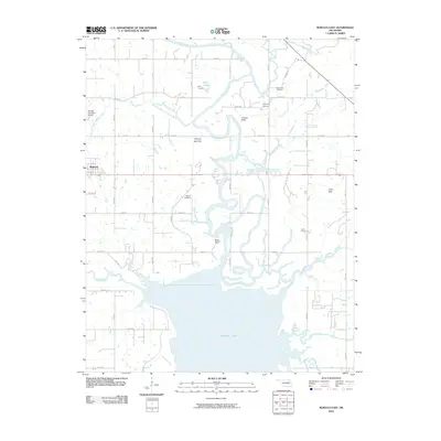
2010 Map of Nowata East
USGS Topo · Published 2010About this map
The Verdigris River carves a winding path through this landscape, leading into the northern reaches of Oologah Lake. This 2010 survey shows the transition from the municipal boundaries of Nowata into the fertile river plains and uplands of eastern Nowata County. The terrain is marked by distinctive natural features such as the Overcup Bottoms and Slate Bluff, while the Coker Hills rise to the east.
Find a feature on this map
31 named features on this map. Tap any name to fly to it.
Don’t see what you’re looking for? This feature index may not catch every label — zoom into the map to look around manually.
Map Details
Editions of this 2010 Nowata East Map
This is the sole edition of this map. No revisions or reprints were ever made.
Other maps of this area

1901 · Nowata
USGS Topo · 1:125,000

1901 · Vinita
USGS Topo · 1:125,000

1913 · Vinita
USGS Topo · 1:125,000

1914 · Nowata
USGS Topo · 1:125,000

1954 · Tulsa
USGS Topo · 1:250,000

1958 · Tulsa
USGS Topo · 1:250,000

1963 · Tulsa
USGS Topo · 1:250,000

1970 · Chelsea
USGS Topo · 1:24,000
1970 · Talala
USGS Topo · 1:24,000
1970 · Winganon
USGS Topo · 1:24,000