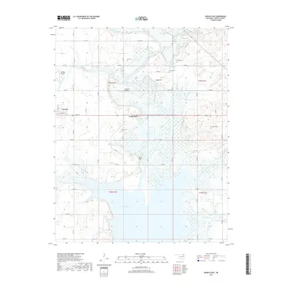
2019 Map of Nowata East
USGS Topo · Published 2019About this map
Oologah Lake dominates the southern reaches of this landscape, its expansive waters meeting the meandering Verdigris River and its various tributaries. The town of Nowata sits on the western edge of the quadrangle, serving as a gateway to the diverse terrain of the Cherokee Nation land. Moving east, the topography rises into the Coker Hills and prominent elevations such as Slate Bluff and Coodys Bluff, which overlook the low-lying Overcup Bottoms. A strong genealogical record is preserved through numerous family and community burial sites, including Riley Cem, Secondine Cem, and Brown Cem, scattered across the rural sections. The infrastructure reflects a blend of local transit and regional aviation at the Nowata Municipal Airport, while the hydrography of Big Creek and Lightning Creek continues to shape the agricultural drainage of the region.
Find a feature on this map
55 named features on this map. Tap any name to fly to it.
Don’t see what you’re looking for? This feature index may not catch every label — zoom into the map to look around manually.
Map Details
Editions of this 2019 Nowata East Map
This is the sole edition of this map. No revisions or reprints were ever made.
Other maps of this area

1901 · Nowata
USGS Topo · 1:125,000

1901 · Vinita
USGS Topo · 1:125,000

1913 · Vinita
USGS Topo · 1:125,000

1914 · Nowata
USGS Topo · 1:125,000

1954 · Tulsa
USGS Topo · 1:250,000

1958 · Tulsa
USGS Topo · 1:250,000

1963 · Tulsa
USGS Topo · 1:250,000

1970 · Chelsea
USGS Topo · 1:24,000
1970 · Talala
USGS Topo · 1:24,000
1970 · Winganon
USGS Topo · 1:24,000