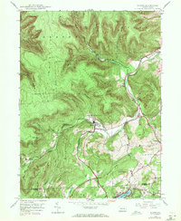
1946 Map of Noxen
USGS Topo · Published 1971About this map
Noxen serves as the focal point of this mid-century topographic study, situated along the banks of Bowman Creek at the foot of Noxen Mountain. The landscape is dominated by the high ridgelines of Schooley Mountain and Forkston Mountain, while the southern portion of the sheet reveals the northern shores of Harveys Lake. An Old Railroad Grade and active Railroad lines trace the creek valleys, indicating the area's history of timber or coal transport. Smaller settlements like Stull, Evans Falls, and Beaumont provide a glimpse into the rural community structure of the time, punctuated by landmarks such as the Childrens Welfare Center and Hettesheimer Corners. This 1946 data, updated with 1969 aerial revisions, preserves the transition between the post-war industrial landscape and the developing residential clusters near the Wyoming and Luzerne county line.
Find a feature on this map
34 named features on this map. Tap any name to fly to it.
Don’t see what you’re looking for? This feature index may not catch every label — zoom into the map to look around manually.
Map Details
Editions of this 1946 Noxen Map
5 editions found

Other maps of this area

1891 · Harveys Lake
USGS Topo · 1:62,500

1893 · Harvey Lake
USGS Topo · 1:62,500

1893 · Pittston
USGS Topo · 1:62,500

1943 · Scranton
USGS Topo · 1:125,000

1945 · Meshoppen
USGS Topo · 1:62,500

1945 · Jenningsville
USGS Topo · 1:24,000

1945 · Meshoppen
USGS Topo · 1:24,000

1946 · Tunkhannock
USGS Topo · 1:62,500

1946 · Kingston
USGS Topo · 1:24,000

1946 · Dutch Mtn
USGS Topo · 1:24,000