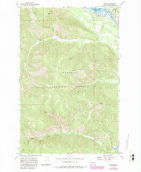
1966 Map of Noxon
USGS Topo · Published 1984About this map
Noxon sits along the northeastern bank of the Clark Fork, where the river expands into the Cabinet Gorge Reservoir. This mid-century view captures the intersection of water and rail, with the B N railroad line skirting the shoreline. Most of the terrain is defined by the high ridges of the Kaniksu National Forest, dominated by Huckleberry Mountain and Stevens Peak. The landscape is deeply incised by drainages like Pilgrim Creek and Marten Creek, which flow toward the river from the high western peaks.
Find a feature on this map
30 named features on this map. Tap any name to fly to it.
Don’t see what you’re looking for? This feature index may not catch every label — zoom into the map to look around manually.
Map Details
Editions of this 1966 Noxon Map
2 editions found
Other maps of this area

1920 · Libby
USGS Topo · 1:125,000

1930 · Libby
USGS Topo · 1:125,000

1932 · Libby
USGS Topo · 1:125,000

1932 · Trout Creek
USGS Topo · 1:125,000

1935 · Trout Creek
USGS Topo · 1:125,000

1936 · Trout Creek
USGS Topo · 1:125,000

1956 · Wallace
USGS Topo · 1:250,000

1957 · Kalispell
USGS Topo · 1:250,000

1960 · Kalispell
USGS Topo · 1:250,000

1960 · Wallace
USGS Topo · 1:250,000