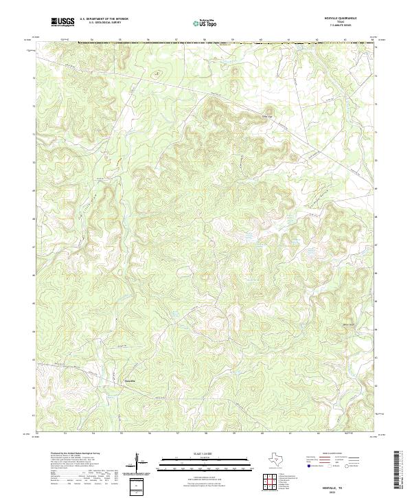
2022 Map of Noxville
USGS Topo · Published 2022About this map
Noxville occupies the lower southern reaches of this landscape, situated near the confluence of local drainages and the James River. The terrain is defined by a complex network of springs and hollows, where water sources like Chimney Hollow Spring, Walker Spring, and Flat Rock Spring emerge from the limestone topography typical of this part of Kimble County. These springs were historically vital for sustaining livestock and early homesteads in an area where surface water often runs through seasonal draws like Jim Little Draw or is concentrated in the Little Devils River.
Find a feature on this map
35 named features on this map. Tap any name to fly to it.
Don’t see what you’re looking for? This feature index may not catch every label — zoom into the map to look around manually.
Map Details
Editions of this 2022 Noxville Map
This is the sole edition of this map. No revisions or reprints were ever made.
Other maps of this area

1887 · Mason
USGS Topo · 1:125,000

1894 · Mason
USGS Topo · 1:125,000

1894 · Kerrville
USGS Topo · 1:125,000

1954 · Llano
USGS Topo · 1:250,000

1955 · Llano
USGS Topo · 1:250,000

1956 · Llano
USGS Topo · 1:250,000
1967 · Monument Mountain SE
USGS Topo · 1:24,000

1968 · Monument Mountain
USGS Topo · 1:24,000

1968 · Yates
USGS Topo · 1:24,000
1974 · Noxville
USGS Topo · 1:24,000