Loading...
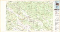
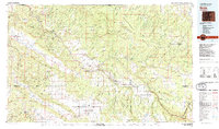
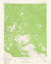
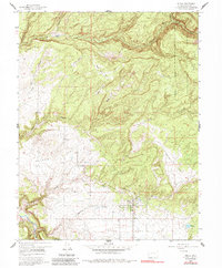
Loading map...1983 Map of Nucla
USGS Topo · Published 1983About this map
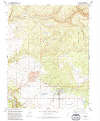
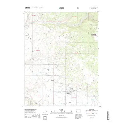
Mining operations and remote settlements define this high plateau landscape of western Colorado during the early 1980s. The deep canyons of the Dolores River and San Miguel River carve through the terrain, sheltering historic uranium and vanadium company towns like Uravan and Vancorum. This map captures the region's industrial footprint, from the Radium Mine and Sunrise Mine to the extensive Shamrock Mines, illustrating the era's reliance on mineral extraction within the Paradox Valley.
Find a feature on this map
66 named features on this map. Tap any name to fly to it.
Don’t see what you’re looking for? This feature index may not catch every label — zoom into the map to look around manually.
Map Details
Date Portrayed1983
Date Published1983
PublisherU.S. Geological Survey
Map TypeTopographic
Scale1:100,000
Physical Dimensions44.16 x 23.9 inches
Editions of this 1983 Nucla Map
2 editions found
Historical Maps of Nucla Through Time
9 maps found

Featured Locations
Source Details
SourceU.S. Geological Survey
CopyrightPublic Domain