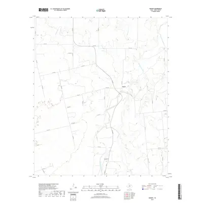
2019 Map of Nugent
USGS Topo · Published 2019About this map
Nugent sits near the center of this Jones County landscape, where the meandering course of the Clear Fork Brazos River dictates the local geography. The river valley is joined by several tributaries, including Mesquite Cr from the northwest and Flatrock Cr from the north, creating a broken terrain of drainages and creek beds. Near the southern edge of the survey, the Fort Phantom Hill Cem serves as a significant landmark for genealogists and local historians, situated along FM 600 S. The area is defined by a network of rural routes such as Co RD 348 and Ranch Rd, reflecting a traditional Texas ranching and farming layout where property access and water sources like Elm Cr remain central to the community's footprint.
Find a feature on this map
33 named features on this map. Tap any name to fly to it.
Don’t see what you’re looking for? This feature index may not catch every label — zoom into the map to look around manually.
Map Details
Editions of this 2019 Nugent Map
This is the sole edition of this map. No revisions or reprints were ever made.
Other maps of this area

1891 · Anson
USGS Topo · 1:125,000

1893 · Anson
USGS Topo · 1:125,000

1954 · Abilene
USGS Topo · 1:250,000

1957 · Hawley
USGS Topo · 1:62,500

1957 · Nugent
USGS Topo · 1:62,500
1957 · Hawley
USGS Topo · 1:24,000
1957 · Hamby
USGS Topo · 1:24,000

1958 · Abilene
USGS Topo · 1:250,000

1965 · Lueders West
USGS Topo · 1:24,000

1965 · Lueders East
USGS Topo · 1:24,000