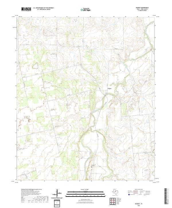
2022 Map of Nugent
USGS Topo · Published 2022About this map
Fort Phantom Hill Cem sits near the southern edge of this West Texas landscape, a focal point for genealogical research in Jones County. The terrain is defined by the winding course of the Clear Fork Brazos River, which cuts through the central portion of the map near the settlement of Nugent. This waterway is joined by several tributaries, including Elm Cr and Flatrock Cr, creating a complex network of seasonal drainages across the prairie. The road system is a mix of state-maintained routes like FM 600 S and numerous rural paths such as W Lake Rd and Ranch Rd, illustrating the modern connectivity of this ranching and agricultural region. The map provides a clear view of how rural properties are organized around these watercourses and historical landmarks.
Find a feature on this map
33 named features on this map. Tap any name to fly to it.
Don’t see what you’re looking for? This feature index may not catch every label — zoom into the map to look around manually.
Map Details
Editions of this 2022 Nugent Map
This is the sole edition of this map. No revisions or reprints were ever made.
Other maps of this area

1891 · Anson
USGS Topo · 1:125,000

1893 · Anson
USGS Topo · 1:125,000

1954 · Abilene
USGS Topo · 1:250,000

1957 · Hawley
USGS Topo · 1:62,500

1957 · Nugent
USGS Topo · 1:62,500
1957 · Hawley
USGS Topo · 1:24,000
1957 · Hamby
USGS Topo · 1:24,000

1958 · Abilene
USGS Topo · 1:250,000

1965 · Lueders West
USGS Topo · 1:24,000

1965 · Lueders East
USGS Topo · 1:24,000