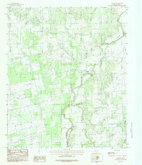
1984 Map of Nugent
USGS Topo · Published 1984About this map
The Clear Fork Brazos River winds through the heart of this Jones County landscape, defining the local geography as it serpentines between rugged breaks and alluvial bottoms. The small community of Nugent sits at a critical junction near where the river meets Flatrock Creek, serving as a focal point for the surrounding ranching and agricultural land. This 1978 field-checked survey highlights the significance of water management in the Texas interior, noting an Aqueduct and an Underground Pipeline traversing the terrain.
Find a feature on this map
10 named features on this map. Tap any name to fly to it.
Don’t see what you’re looking for? This feature index may not catch every label — zoom into the map to look around manually.
Map Details
Editions of this 1984 Nugent Map
This is the sole edition of this map. No revisions or reprints were ever made.
Other maps of this area

1891 · Anson
USGS Topo · 1:125,000

1893 · Anson
USGS Topo · 1:125,000

1954 · Abilene
USGS Topo · 1:250,000

1957 · Hawley
USGS Topo · 1:62,500

1957 · Nugent
USGS Topo · 1:62,500
1957 · Hawley
USGS Topo · 1:24,000
1957 · Hamby
USGS Topo · 1:24,000

1958 · Abilene
USGS Topo · 1:250,000

1965 · Lueders West
USGS Topo · 1:24,000

1965 · Lueders East
USGS Topo · 1:24,000