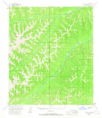
1953 Map of Nulato C-6
USGS Topo · Published 1967About this map
The Nulato River and its major tributary, the South Fork Nulato River, dominate the drainage patterns of this interior Alaskan landscape. Mapping based on 1952 aerial photography reveals a wilderness setting where transportation was primarily limited to water or air, indicated by an isolated Landing Strip near the river's edge. This 1953 field-annotated sheet captures a moment when early energy exploration reached the region, evidenced by a lonely Oil Well (Aband) located east of the main river channel. The topographic data also traces the Kateel River Principal Meridian, a critical surveying baseline for the Bureau of Land Management's pre-determined but then-unmarked land lines. Further southeast, the Ninemi l e R i v e r cuts through the terrain, illustrating the intricate network of waterways defining the Yukon-Koyukuk region.
Find a feature on this map
6 named features on this map. Tap any name to fly to it.
Don’t see what you’re looking for? This feature index may not catch every label — zoom into the map to look around manually.
Map Details
Editions of this 1953 Nulato C-6 Map
This is the sole edition of this map. No revisions or reprints were ever made.
Other maps of this area

1945 · Nulato
USGS Topo · 1:250,000

1948 · Norton Bay
USGS Topo · 1:250,000

1951 · Nulato
USGS Topo · 1:250,000

1951 · Norton Bay
USGS Topo · 1:250,000

1952 · Nulato B-6
USGS Topo · 1:63,360

1952 · Nulato D-5
USGS Topo · 1:63,360

1952 · Norton Bay B-1
USGS Topo · 1:63,360

1952 · Nulato B-5
USGS Topo · 1:63,360

1952 · Nulato C-6
USGS Topo · 1:63,360

1952 · Nulato C-5
USGS Topo · 1:63,360