
1952 Map of Nulato B-6
USGS Topo · Published 1957About this map
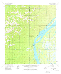
Kaltag stands as a primary riverfront hub on the west bank of the Yukon River in the early 1950s. This interior Alaskan landscape is defined by the strategic intersection of river travel and overland routes, including a significant Portage and an Abandoned Telegraph Line that tracks along the river bluffs. The settlement pattern reflects both the traditional and modern infrastructure of the era, with the Kaltag Radio Station, a Landing Strip, and Tanks appearing alongside seasonal outposts like Fourmile Camp and a noted Cem. The drainage of the Kaltag River and Rodo River cut through the high ground of Notakok Mountain, while the wide Yukon channel is shaped by Short Island and Sevenmile Island. South of the main village, the site of Rodokakat (Abn) indicates a shift in local habitation by mid-century.
Find a feature on this map
21 named features on this map. Tap any name to fly to it.
Don’t see what you’re looking for? This feature index may not catch every label — zoom into the map to look around manually.
Map Details
Editions of this 1952 Nulato B-6 Map
2 editions found
Other maps of this area

1945 · Nulato
USGS Topo · 1:250,000

1948 · Norton Bay
USGS Topo · 1:250,000

1951 · Nulato
USGS Topo · 1:250,000

1951 · Norton Bay
USGS Topo · 1:250,000

1952 · Nulato A-5
USGS Topo · 1:63,360

1952 · Norton Bay B-1
USGS Topo · 1:63,360

1952 · Nulato B-5
USGS Topo · 1:63,360

1952 · Nulato C-6
USGS Topo · 1:63,360

1952 · Nulato C-5
USGS Topo · 1:63,360

1952 · Nulato
USGS Topo · 1:250,000