
1952 Map of Nulato A-5
USGS Topo · Published 1957About this map
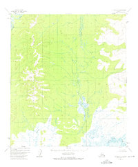
The Kaiyuh Mountains dominate the western portion of this 1952 landscape, where high ridgelines overlook a complex drainage system in the Alaska interior. The topographic relief is defined by Magitchlie Creek, which flows south along the base of the mountains, and the winding Khotol River that cuts through the northwestern corner. To the east, the terrain transitions into a broad expanse of lowlands and wetlands, characterized by the meandering courses of the Mud River and the Little Mud River. Mapped by the U.S. Geological Survey using aerial photography from the early 1950s, this quadrangle reveals a territory without established roads or trails, focusing instead on the natural hydrology and elevation of the Yukon-Koyukuk region. The dense network of marshes and smaller water bodies illustrates the seasonal dynamics of a subarctic floodplain.
Find a feature on this map
5 named features on this map. Tap any name to fly to it.
Don’t see what you’re looking for? This feature index may not catch every label — zoom into the map to look around manually.
Map Details
Editions of this 1952 Nulato A-5 Map
2 editions found
Other maps of this area

1945 · Nulato
USGS Topo · 1:250,000

1951 · Ophir
USGS Topo · 1:250,000

1951 · Nulato
USGS Topo · 1:250,000

1952 · Nulato B-6
USGS Topo · 1:63,360

1952 · Nulato A-4
USGS Topo · 1:63,360

1952 · Nulato B-5
USGS Topo · 1:63,360

1952 · Nulato B-4
USGS Topo · 1:63,360

1952 · Nulato
USGS Topo · 1:250,000

1952 · Nulato A-6
USGS Topo · 1:63,360
1953 · Nulato A-4
USGS Topo · 1:63,360