
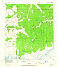
1952 Map of Nulato A-4
USGS Topo · Published 1957About this map
Khotol Mountain and the Kaiyuh Mountains dominate this mid-century topographic portrait of the Alaskan interior. The landscape is defined by the drainage patterns of the Little Mud River and the Kitali Mud River, which wind through the lowlands at the base of these prominent elevations. In this era, the Geological Survey utilized aerial photography from 1952 to map the intricate networks of Yukon Creek and Eddy Creek. The topography shows a transition from the structured ridges of the northern mountains to the meandering, water-saturated plains in the south. This survey provides a primary look at the watershed before modern shifts in river channels, serving as a baseline for understanding the physical geography of this portion of the Alaska-Fourth Judicial Division.
Find a feature on this map
6 named features on this map. Tap any name to fly to it.
Don’t see what you’re looking for? This feature index may not catch every label — zoom into the map to look around manually.
Map Details
Editions of this 1952 Nulato A-4 Map
This is the sole edition of this map. No revisions or reprints were ever made.
Other maps of this area

1945 · Nulato
USGS Topo · 1:250,000

1951 · Ophir
USGS Topo · 1:250,000

1951 · Nulato
USGS Topo · 1:250,000

1952 · Nulato A-5
USGS Topo · 1:63,360

1952 · Nulato B-5
USGS Topo · 1:63,360

1952 · Nulato B-3
USGS Topo · 1:63,360

1952 · Nulato B-4
USGS Topo · 1:63,360

1952 · Nulato A-3
USGS Topo · 1:63,360

1952 · Nulato
USGS Topo · 1:250,000
1953 · Nulato A-4
USGS Topo · 1:63,360