
1952 Map of Nulato B-3
USGS Topo · Published 1957About this map
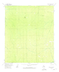
Totson Mountain stands as a central peak within the expansive Kaiyuh Mountains during this mid-century period in the Alaska Interior. The landscape is defined by a dense network of watercourses, with Bonanza Creek and Bishop Creek draining the northern slopes, while the Yuki River edges the southeastern corner of the quadrangle. High-elevation triangulation stations, such as VABM 2714 Bishop and VABM 2053 Kalakaket, mark the primary summits used for the 1950s photogrammetric mapping process. This survey, compiled from 1952 aerial photography, captures a wilderness area devoid of roads or permanent settlements, where drainages like Kala Creek and Camp Creek provided the only natural corridors through the high country of the Fourth Judicial Division.
Find a feature on this map
12 named features on this map. Tap any name to fly to it.
Don’t see what you’re looking for? This feature index may not catch every label — zoom into the map to look around manually.
Map Details
Editions of this 1952 Nulato B-3 Map
2 editions found
Other maps of this area

1945 · Nulato
USGS Topo · 1:250,000

1951 · Nulato
USGS Topo · 1:250,000

1952 · Nulato B-2
USGS Topo · 1:63,360

1952 · Nulato C-3
USGS Topo · 1:63,360

1952 · Nulato C-2
USGS Topo · 1:63,360

1952 · Nulato C-4
USGS Topo · 1:63,360

1952 · Nulato A-2
USGS Topo · 1:63,360

1952 · Nulato A-4
USGS Topo · 1:63,360

1952 · Nulato B-4
USGS Topo · 1:63,360

1952 · Nulato A-3
USGS Topo · 1:63,360