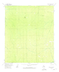
1952 Map of Nulato B-3
USGS Topo · Published 1974About this map
Totson Mountain dominates the central landscape of this interior Alaska wilderness, serving as a primary landmark for a region defined by its intricate drainage systems. The survey, based on 1952 aerial photography, captures the unpopulated terrain along the Yuki River and its numerous tributaries. These watercourses, including Bonanza Creek and Kala Creek, were essential for navigation and access before modern infrastructure reached the area.
Find a feature on this map
12 named features on this map. Tap any name to fly to it.
Don’t see what you’re looking for? This feature index may not catch every label — zoom into the map to look around manually.
Map Details
Editions of this 1952 Nulato B-3 Map
2 editions found
Other maps of this area

1945 · Nulato
USGS Topo · 1:250,000

1951 · Nulato
USGS Topo · 1:250,000

1952 · Nulato B-2
USGS Topo · 1:63,360

1952 · Nulato C-3
USGS Topo · 1:63,360

1952 · Nulato C-2
USGS Topo · 1:63,360

1952 · Nulato C-4
USGS Topo · 1:63,360

1952 · Nulato A-2
USGS Topo · 1:63,360

1952 · Nulato A-4
USGS Topo · 1:63,360

1952 · Nulato B-3
USGS Topo · 1:63,360

1952 · Nulato B-4
USGS Topo · 1:63,360