
1952 Map of Nulato C-3
USGS Topo · Published 1957About this map
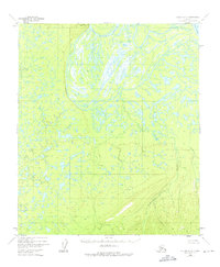
The Yukon River defines the northeastern edge of this interior landscape, where the water complexly braids into the Pilot Mountain Slough. This 1952 survey, which was not field-checked, relies on aerial photography to document a wilderness of muskeg and thaw lakes that transition into the rising terrain of the Bishop Mountains. Dominating the northern horizon is Pilot Mountain, a primary geodetic landmark at an elevation of 1,609 feet. The drainage patterns of Kinkaid Creek and numerous unnamed tributaries illustrate the intricate hydrological network typical of the Alaska-Fourth Judicial Division before modern infrastructure was introduced to the region. The map captures a moment in the mid-20th century when the area remained primarily accessible by river, showcasing the natural state of the Yukon valley and its surrounding highlands.
Find a feature on this map
5 named features on this map. Tap any name to fly to it.
Don’t see what you’re looking for? This feature index may not catch every label — zoom into the map to look around manually.
Map Details
Editions of this 1952 Nulato C-3 Map
4 editions found
Other maps of this area

1945 · Nulato
USGS Topo · 1:250,000

1951 · Nulato
USGS Topo · 1:250,000

1952 · Nulato D-3
USGS Topo · 1:63,360

1952 · Nulato B-2
USGS Topo · 1:63,360

1952 · Nulato C-2
USGS Topo · 1:63,360

1952 · Nulato C-4
USGS Topo · 1:63,360

1952 · Nulato D-4
USGS Topo · 1:63,360

1952 · Nulato D-2
USGS Topo · 1:63,360

1952 · Nulato B-3
USGS Topo · 1:63,360

1952 · Nulato B-4
USGS Topo · 1:63,360